I Stood on the Edge of the Ripio, Chain Grease on My Thumbs
The smell hit first: crushed damp southern beech, volcanic ozone, and the metallic tang of fresh rain hitting hot brake rotors. I had just hauled my loaded rig off the overnight ferry at Puerto Chaitén. The air was so crisp it burned the back of my throat. Around me, the Chilean Andes rose like jagged teeth through torn wool clouds, dripping with glacial melt. My tires—47mm tubeless set to a supple 28 PSI—sank half an inch into loose ripio gravel. My legs were exhausted, my thumb was stained with dry chain lube, and I had never felt more alive.
Cycle touring isn't about passing through a place. It’s about letting the landscape grind itself into your skin at fifteen miles per hour.
If you are tired of sanitized resort holidays and predictable road trips, you are not alone. A quiet revolution is happening on two wheels. Bikepacking veterans and ultra-endurance cyclists are abandoning crowded European rail corridors for raw, backcountry routes that reward sheer physical effort with mind-bending scenery.
Below are the definitive, world-class bike touring routes through epic landscapes experts are recommending this year—complete with technical specs, secret spots, and raw logistics.
---
1. The Carretera Austral (Ruta 7), Chile: The Wild Frontier of Patagonia
``` Distance: ~1,240 km (770 miles) | Terrain: Loose gravel (ripio), asphalt, wooden bridges | Difficulty: Hard ```
If bike touring had a holy grail, Ruta 7 would be carved on its stem. Snaking south from Puerto Montt to the end of the road at Villa O'Higgins, Chile’s Carretera Austral cuts through temperate rainforests, fjords, active volcanoes, and massive hanging glaciers.
Why Experts Recommend It
The Carretera Austral is changing fast. Paving projects advance every year, meaning the window to ride its wild, unpaved core in its raw form is closing. Experienced tourers highlight the stretch between Coyhaique and Cochrane as one of the most visually staggering corridors on earth. You will ride past the neon-turquoise waters of the Río Baker, carve through the newly established Patagonia National Park, and navigate mountain passes where condors ride the updrafts directly above your handlebars.
Field Notes & Pro-Tips
- The Tire Sweet Spot: Do not attempt this route on skinny road rubber. Bring at least a 45mm gravel tire or a 2.0-inch mountain bike tire. Loose, tennis-ball-sized river rocks will test your handling.
- Pro-Tip: When passing through Puerto Río Tranquilo, skip the mass-tourist boats to the Marble Caves. Instead, ride 8 kilometers south past town to a small, unmarked wooden gate behind a blue farm barn at kilometer 228. A local farmer named Don Hector lets cyclists pitch a tent on his private beach with a direct, unobstructed view of the lake for 5,000 CLP ($5 USD).
- Resupply Strategy: Food options are sparse south of Villa Cerro Castillo. Carry at least 3–4 days of high-calorie staples (oats, powdered milk, canned sardines, and lentils).
---
2. The Shimanami Kaido, Japan: Island-Hopping the Seto Inland Sea
``` Distance: 70 km (43 miles) | Terrain: Dedicated asphalt cycle paths, suspended bridges | Difficulty: Easy to Moderate ```
Not every epic landscape requires three weeks of suffering in the wilderness. The Shimanami Kaido is an engineering marvel that ribbons across six small islands in Japan’s Seto Inland Sea, linking the main island of Honshu (Onomichi) to Shikoku (Imabari).
Why Experts Recommend It
Route designers world-wide hold up the Shimanami Kaido as the absolute gold standard for coastal cycle infrastructure. Blue navigation lines are painted directly onto the tarmac, guiding you over towering suspension bridges designed with gentle 3% gradient ramps specifically for bicycles. You ride through citrus orchards, past timber fishing villages, and alongside calm, emerald-green sea lanes filled with wooden ferry boats.
Field Notes & Pro-Tips
- The Culinary Fuel: Stop at the island of Ikuchijima. Look for a tiny, unpretentious shop called Minatoya near the Setoda port. They serve wood-fired octopus tempura ramen paired with locally grown Hassaku citrus juice. It is the single greatest cycling lunch in East Asia.
- Pro-Tip: Skip hauling heavy panniers if you are doing a quick tour. Japan’s Takuhaibin (luggage forwarding service) will ship your main luggage from your hotel in Hiroshima or Onomichi directly to your hotel in Imabari for under $15 USD.
- Timing Secret: Cross the Kurushima-Kaikyo Bridge—the longest suspension bridge structure on the route—exactly at golden hour. The setting sun turns the sea into liquid copper, framing the silhouette of passing cargo ships.
---
3. The Pamir Highway (M41), Tajikistan & Kyrgyzstan: Riding the Roof of the World
``` Distance: ~1,250 km (775 miles) | Terrain: Broken tarmac, deep dirt, washboard sand | Difficulty: Extreme ```
For cyclists seeking true remote wilderness, the Pamir Highway stands alone. Reaching altitudes above 4,600 meters (15,000 feet), this ancient Silk Road artery traverses the high-altitude desert plateau of the Pamir Mountains, bordered by Afghanistan’s Wakhan Corridor and the snow-capped Hindu Kush.
Why Experts Recommend It
Expedition cyclists rank the Pamirs among the top three high-altitude bikepacking routes globally. The scale is almost impossible to comprehend: stark, lunar valleys dotted with red lakes, mud-brick Kyrgyz yurts, and mountain peaks rising above 7,000 meters. The cultural immersion is as profound as the physical challenge; hospitalities extended by Pamiri locals in tiny mountain villages are legendary.
Field Notes & Pro-Tips
- Acclimatization is Non-Negotiable: Take at least three rest days in Khorog before pushing into the high plateau above 3,000 meters. High-altitude pulmonary edema (HAPE) is a real risk here.
- Pro-Tip: Take the detour through the Wakhan Corridor via Ishkashim and Langar rather than staying on the northern main highway. The road is rougher, but you ride directly along the Panj River, looking straight across a 50-meter water barrier into Afghan villages, backed by the white wall of the Pamir mountains.
- Essential Gear: Bring a multi-fuel stove (like a Primus OmniFuel) that can run on low-octane motor gasoline. Isobutane gas canisters are virtually non-existent between Dushanbe and Osh.
---
4. The Westfjords Way (Vestfjarðaleiðin), Iceland: Raw Nordic Drama
``` Distance: ~950 km (590 miles) | Terrain: Mountain gravel, coastal tarmac, single-lane tunnels | Difficulty: Challenging ```
While most tourists circle Iceland on the busy Ring Road (Route 1), expert bike tourers head straight for the isolated northwest peninsula: the Westfjords. This jagged coastline is carved by dozens of deep fjords, towering sea cliffs, and gravel mountain passes that see a fraction of the country’s vehicular traffic.
Why Experts Recommend It
Route developers officially launched the Westfjords Way cycling loop to highlight Iceland’s most dramatic geography. You will cycle alongside roaring Arctic oceans, pass bird cliffs swarming with puffins, and cross high mountain plateaus where snow walls frame the gravel road late into July.
Field Notes & Pro-Tips
- Hot Spring Protocol: Iceland’s geothermal energy is a cycle tourer’s ultimate recovery tool. Download the map for wild geothermal pools.
- Pro-Tip: Just off Route 60, pull over at Hellulaug, a natural geothermal spring built into the rocks right at the ocean's edge. It is completely free, heated to a constant 38°C (100°F), and completely hidden from the main road above.
- Gearing Warning: Winds in the Westfjords are relentless. A 1x drivetrain with a 32T chainring and an 11-52T cassette will save your knees when grinding into a 40-knot headwind on a 10% dirt climb.
---
5. The Hebridean Way, Outer Hebrides, Scotland: Ocean Winds and Ancient Stone
``` Distance: 297 km (185 miles) | Terrain: Single-track bitumen, causeways, ferry links | Difficulty: Moderate ```
Spanning ten islands off the west coast of Scotland, the Hebridean Way is an island-hopping epic connected by causeways and roll-on, roll-off ferries. Starting on the southern island of Vatersay and ending at the Butt of Lewis lighthouse in the north, this route immerses you in Atlantic sea air, white shell beaches, and prehistoric history.
Why Experts Recommend It
The Outer Hebrides feel like the edge of the earth without requiring deep wilderness survival skills. The landscape shifts rapidly: from the unique machair (rare coastal shell-sand grassland carpeted in summer wildflowers) to dark, brooding peat bogs and dramatic sea stacks.
Field Notes & Pro-Tips
- The Wind Direction Rule: Always ride south to north. The prevailing Atlantic winds blow heavily from the southwest. Riding north to south turns a glorious tailwind journey into a punishing battle against gale-force wind.
- Pro-Tip: Stop at the Callanish Standing Stones on the Isle of Lewis at 6:30 AM before the tour buses arrive. The morning mist hanging over the 5,000-year-old megaliths while sitting on your bicycle top tube is a surreal, unforgettable experience.
- Culinary Stop: Look for the self-service honesty boxes outside homes on South Uist selling fresh hot-smoked salmon and homemade shortbread. Leave a few coins in the tin and feast on world-class seafood on the beach.
---
Bike Touring Gear Setup: The Expert Consensus
When taking on multi-day bike touring routes through epic landscapes, gear choice determines whether your trip is an epic adventure or a miserable rescue operation.
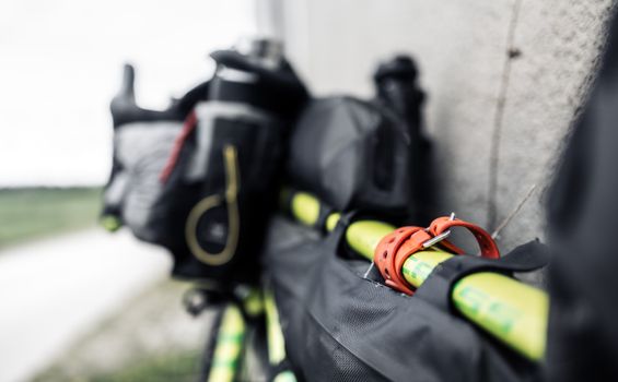
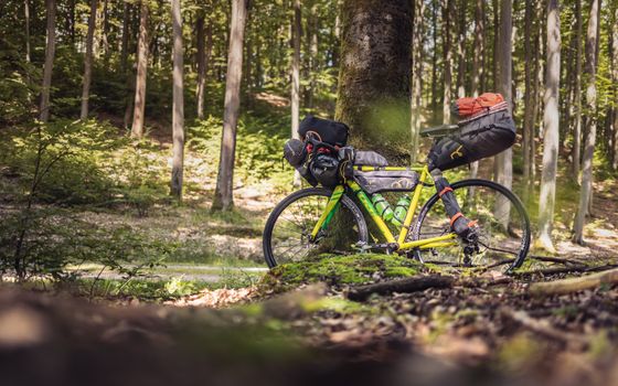
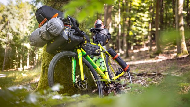
``` [SEATPACK: 10-15L] Lightweight gear: Sleeping bag, down jacket, dry clothes / / [FRAME BAG: 4-6L] [HANDLEBAR ROLL: 10-15L] Heavy items: Electronics, Tent body, footprint, tools, stove, food, water sleeping pad \ \ [FORK BAGS / CARGO CAGES] Water bottles, extra fuel, cooking pot ```
The Modern Bikepacking Setup vs. Traditional Panniers
- Gravel/Rough Off-Road Routes (Carretera Austral, Pamir): Soft-bag bikepacking setups (seatpack, frame bag, handlebar roll) keep the bike’s center of Gravity narrow and prevent panniers from rattling loose on heavy washboard roads.
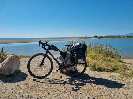
- Paved Long-Distance Routes (Shimanami Kaido, Hebridean Way): Traditional low-rider front racks and rear panniers offer superior waterproof storage capacity and make packing/unpacking faster at hotels or campsites.
---
Quick Facts & Budget Breakdown
Planning logistics can be daunting. Here is how these top five routes compare on paper:
| Route | Best Time to Visit | Est. Daily Budget ($ USD) | Recommended Bike Type | How to Access Starting Point | | :--- | :--- | :--- | :--- | :--- | | Carretera Austral | Dec – March (Southern Summer) | $35 – $65 (Camping/Cook) | Gravel or Hardtail MTB (45mm+ tires) | Fly to Puerto Montt (PMC), ferry to Chaitén | | Shimanami Kaido | Oct – Nov / April – May | $70 – $140 (Hotels/Food) | Road, Touring, or E-Bike | Train from Hiroshima to Onomichi | | Pamir Highway | June – September | $20 – $40 (Homestays) | Rigded MTB or Expedition Touring | Fly to Dushanbe (Tajikistan) | | Westfjords Way | Late June – August | $60 – $110 (Wild Camp/Hostel) | Gravel Bike (40mm–50mm tires) | Domestic flight or drive from Reykjavík | | Hebridean Way | May – July | $50 – $90 (B&B/Camping) | Touring or Gravel Bike | Ferry from Oban to Castlebay (Barra) |
---
3 Rules for Riding Epic Landscapes
- Respect the Local Microclimate: Mountains create their own weather. A clear sky at 8 AM on the Pamir Highway or in the Westfjords can transform into a freezing sleet storm by noon. Pack waterproof layers (GORE-TEX or equivalent) in your outer handlebar roll, never at the bottom of your frame bag.
- Leave No Trace on the Trail: Remote routes are fragile ecosystems. If you pack it in, pack it out—including food scraps, wet wipes, and tire tubes. Respect private land access rules, especially in Scotland (where the Right to Roam applies responsibly) and Iceland (where wild camping in non-designated areas has strict rules).
- Gear down and look up: It is easy to get locked into watching your front tire spin over gravel. Remember why you are out there. Gear down, drop your cadence, breathe in the salt air or high-altitude oxygen, and look up at the horizon.
There is no feeling on earth quite like earning a view through your own pedal strokes. Pick a route, tune your derailleur, pack your bags, and ride.
---