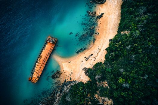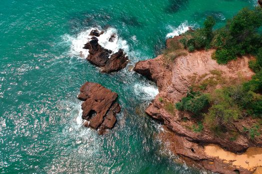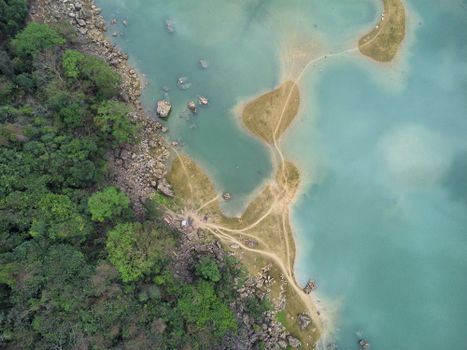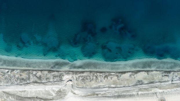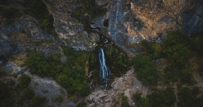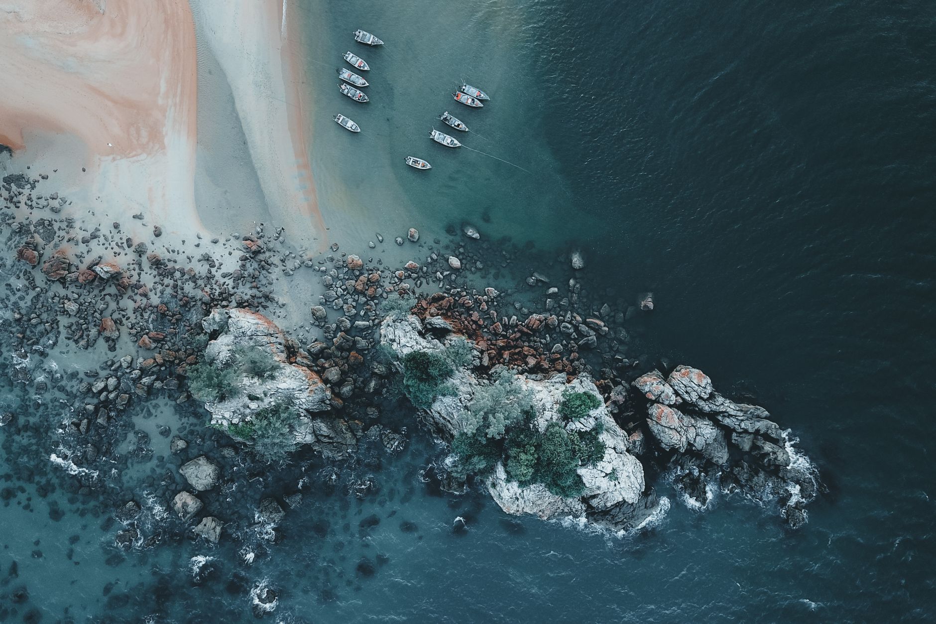
The wind was whipping, salt spray misting my face as I stood on a rugged cliff edge, my drone's rotors whirring softly as it ascended. Below, a crescent of golden sand lay cradled between towering, ancient rock formations, the turquoise Atlantic Ocean crashing in rhythmic perfection. There wasn't another soul in sight for miles, just the raw, untamed beauty of Portugal's wild west coast. This wasn't the crowded Algarve; this was a secret, a place a local fisherman had whispered about over a plate of grilled sardines, a place he said was "too beautiful for the postcards."
That moment, the one where my drone captured an aerial masterpiece that felt utterly unique and profoundly personal, solidified my obsession: finding those hidden drone photography gems. The iconic spots are fantastic, don't get me wrong. But there’s a distinct thrill, a deeper satisfaction, in discovering a vista that hasn't been plastered across every travel feed. These are the places that locals often cherish, perhaps quietly hoping they remain their own slice of paradise, untouched by the masses. And today, I’m going to share some of those whispers with you – not to spoil them, but to inspire responsible, respectful exploration and capture truly unforgettable aerial stories.
The Lure of the Unseen: Why Go Off-Grid for Drone Shots?
Let's be honest, how many times have you scrolled past the same drone shot of Horseshoe Bend or the Cliffs of Moher? While undeniably stunning, the sheer volume of identical content can make your own efforts feel... less unique. This isn't about shunning popular spots, but about expanding your horizons.
Seeking out lesser-known drone locations offers a profound sense of adventure and discovery. It forces you to delve deeper into a destination, often leading to richer cultural interactions and a more authentic travel experience. You'll navigate winding roads, trek through untouched landscapes, and sometimes even learn a few local phrases just to ask for directions. This effort isn't just for the 'gram'; it's for the soul. The reward isn't just a stunning photo, but the story of how you got it.
More importantly, these hidden gems often offer a tranquility that crowded tourist hubs simply can't. Imagine the serene hum of your drone being the only sound as you capture a sunrise over an ancient, forgotten ruin, or the gentle lapping of waves against a deserted shore. This peace allows for better focus, more creative composition, and ultimately, more impactful imagery.
But here’s the crucial caveat: "locals don't want tourists to know" isn't an invitation to disrespect or intrude. It's a playful nod to the desire to preserve tranquility. Our goal as responsible drone pilots and travelers is to appreciate these places with the utmost respect for their natural beauty, local communities, and existing regulations. We fly quietly, leave no trace, and support local businesses when we can.
Navigating the Skies: Essential Drone Regulations & Etiquette
Before we lift off to these secret spots, let's get serious for a moment. Responsible drone flying is paramount. The last thing we want is to contribute to a location becoming a "no-fly zone" due to irresponsible pilots.
- Know Before You Go (and Fly!): Every country, and often every region or even municipality, has its own drone laws. This is non-negotiable. Use apps like AirMap or consult official aviation authority websites. Look for:
- Registration requirements: Do you need to register your drone?
- Permits: Is a specific permit required for recreational or commercial flying?
- No-fly zones: Airports, military bases, national parks, government buildings, private property, and often crowded areas are typically off-limits.
- Altitude limits: Max height restrictions are common.
- Line of sight: You usually need to keep your drone within your visual line of sight.
- Privacy: Be acutely aware of people's privacy. Don't fly over private homes or film individuals without explicit consent.
- Respect Wildlife & Environment: Your drone can be a disturbance. Maintain a safe distance from animals, especially nesting birds or sensitive ecosystems. Never fly in a way that could cause stress or harm.
- Local Etiquette: Some communities might have unwritten rules or cultural sensitivities. If you're unsure, ask a local. A friendly conversation can go a long way. Always be prepared to not fly if you sense discomfort or if a local asks you not to.
- Insurance: Seriously, get it. Accidents happen.
- Pre-Flight Checks: Always check your drone, controller, and batteries. Ensure GPS signal is strong and calibrate your compass.
- Weather Watch: Wind, rain, and temperature extremes can be drone killers. Check forecasts meticulously.
Remember, we are guests in these skies. Our actions dictate whether these hidden gems remain accessible for future aerial adventures.
Whispers of the Wind: Europe's Secret Aerial Paradises
Europe, with its ancient history and diverse landscapes, holds countless secrets. Beyond the well-trodden paths, these spots offer aerial perspectives that will take your breath away.
1. The Wild Emerald Coastline of Costa Vicentina, Portugal
Forget the crowded beaches of the central Algarve. Venture west to the Parque Natural do Sudoeste Alentejano e Costa Vicentina, a protected coastal stretch running from Odeceixe south to Sagres. This is where the Atlantic truly shows its raw power, carving dramatic cliffs, hidden coves, and vast, empty beaches.
- Why it's a secret: While popular with surfers and hikers, mass tourism hasn't arrived. Locals cherish its wild, untamed beauty. The access roads can be a bit rough, deterring casual visitors.
- What to expect from the air: Imagine endless stretches of golden and dark sand, framed by ochre cliffs plunging into crashing turquoise waves. You can capture surfers riding perfect barrels, the geometric patterns of traditional fishing traps, and the tiny, colorful fishing villages clinging to the cliffside. The contrast of the deep blue ocean against the rugged coastline is truly spectacular.
- My personal take: I stumbled upon Praia da Bordeira near Carrapateira after a tip from a guesthouse owner. Watching my drone ascend over the vast, empty beach, with the river snaking through the dunes and meeting the ocean, felt like I had discovered a new world. The light at golden hour here is simply magical, painting the cliffs in fiery hues.
- Practical Details:
- Location: Southwest Alentejo and Vicentine Coast Natural Park, Portugal. Base yourself in charming towns like Odeceixe, Aljezur, or Carrapateira.
- Getting There: Rent a car – essential for exploring the remote tracks to the best viewpoints.
- Best Time to Fly: Shoulder seasons (April-May, September-October) offer pleasant weather and fewer people. Early morning or late afternoon for golden hour.
- Drone Regulations: Portugal generally allows recreational drone flying with some restrictions (e.g., no flying over people, within 150m of beaches during peak season, etc.). Always check the ANAC (National Civil Aviation Authority) website. Be extra cautious around nature reserves for wildlife.
- Local Tip: Indulge in fresh seafood at a local tasca (tavern) – the grilled fish is unparalleled. Expect to pay €15-€25 for a hearty meal.
2. The Mystical Lesser Peaks of Meteora, Greece
Everyone knows Meteora for its incredible monasteries perched atop sandstone pillars. And rightfully so – it's a UNESCO site. But flying directly over the monasteries is a strict no-go. The secret here lies in the surrounding, equally dramatic, but less-visited rock formations and valleys that offer unparalleled perspectives of the Meteora landscape without violating sacred space.
- Why it's a secret: The focus is always on the monasteries themselves. Few tourists explore the vast, intricate geological formations that stretch beyond the immediate vicinity, offering unique angles and compositions.
- What to expect from the air: Imagine your drone rising to reveal the iconic monasteries peeking out from behind a colossal, unnamed rock pillar, bathed in the soft glow of dawn. You can capture the sheer scale of the landscape, the winding roads looking like ribbons, and the ancient forests clinging to the slopes. The sense of timelessness is palpable.
- My personal take: I spent a morning hiking a lesser-known trail near Kastraki, away from the main monastery routes. Launching my drone from a secluded plateau, I captured a breathtaking panorama: the famous monasteries, dwarfed by the immense landscape, shrouded in a morning mist. It was a shot that told a bigger story than just the buildings themselves.
- Practical Details:
- Location: Thessaly, Greece, near the town of Kalabaka.
- Getting There: Drive or take a train/bus from Athens or Thessaloniki to Kalabaka.
- Best Time to Fly: Early morning (sunrise) or late afternoon (sunset) for dramatic light and fewer people.
- Drone Regulations: Greece has strict drone laws. You generally need permission from the Hellenic Civil Aviation Authority (HCAA) for anything beyond very basic recreational flight, and certainly for commercial use. Crucially, do NOT fly directly over or too close to the monasteries. Focus on the surrounding natural landscape from a respectful distance. Always check local signage.
- Local Tip: Stay in Kastraki for a more authentic experience than Kalabaka. Try local tsipouro (grape pomace brandy) and traditional Greek dishes.
Beyond the Horizon: Asia & Oceania's Untouched Vistas
From ancient civilizations reclaimed by jungle to remote island paradises, Asia and Oceania offer a treasure trove of undiscovered drone locations.
3. The Ancient Jungle Temples of Koh Ker, Cambodia
While Angkor Wat draws millions, the ancient city of Koh Ker, about 120km northeast, remains largely swallowed by the jungle. This former capital of the Khmer Empire offers a truly Indiana Jones-esque experience, with far fewer crowds.
- Why it's a secret: It's further afield than Angkor, requiring a dedicated trip. The temples are less restored, giving them a raw, authentic appeal that not all tourists seek.
- What to expect from the air: Imagine your drone hovering above Prasat Thom, the seven-tiered pyramid temple, its ancient stones peeking through a dense emerald canopy. You can capture the sprawling complex, the intricate relationship between man-made structures and encroaching nature, and the sheer scale of this forgotten city. The sense of discovery from an aerial perspective is immense.
- My personal take: Driving through the dusty red roads to Koh Ker felt like stepping back in time. With my drone, I was able to show how truly isolated and vast this complex is, capturing the jungle reclaiming magnificent structures. A shot of the pyramid from above, with the surrounding forest stretching to the horizon, was a highlight.
- Practical Details:
- Location: Preah Vihear Province, Cambodia.
- Getting There: Best to hire a private car/driver from Siem Reap (approx. 2.5-3 hours drive). Expect to pay $70-$100 for a round trip.
- Entrance Fee: Around $10-15 USD per person.
- Best Time to Fly: Dry season (November-May) for clearer skies, but also hotter. Early morning or late afternoon for best light.
- Drone Regulations: Cambodia's drone laws are evolving. While there's no outright ban, flying over archaeological sites like Koh Ker requires explicit permission from the Apsara Authority (who manage such sites). It's best to inquire locally or through your guide well in advance. Be respectful and discreet.
- Local Tip: Combine with a visit to Beng Mealea temple for another less-crowded, jungle-clad experience. Bring plenty of water and insect repellent.
4. The Rice Terraces of Batad, Ifugao Province, Philippines
Everyone knows Banaue, but Batad offers a more immersive, authentic, and equally stunning experience of the 2000-year-old rice terraces, often called the "Eighth Wonder of the World." It's a challenging journey, which keeps the crowds away.
- Why it's a secret: It requires a significant trek to reach the village, making it less accessible for casual tourists. Locals live a traditional life here, and the terraces are their livelihood.
- What to expect from the air: Imagine sweeping aerial shots of the amphitheater-like terraces, curving and flowing down the mountainside in perfect emerald or golden hues (depending on the season). You can capture the tiny, traditional huts nestled amongst the terraces, the locals tending their crops, and the sheer human ingenuity of this ancient agricultural system. The scale and artistry are breathtaking from above.
- My personal take: The hike into Batad was tough, but the first glimpse of the terraces from the viewpoint made it all worth it. My drone allowed me to truly appreciate the intricate design and the vastness of the terraces, something you can't get from ground level. I captured the villagers going about their day, creating a beautiful story of harmony between man and nature.
- Practical Details:
- Location: Batad, Ifugao Province, Luzon, Philippines.
- Getting There: Overnight bus from Manila to Banaue (approx. 9-10 hours). From Banaue, take a jeepney or tricycle to Batad junction, then a 1-2 hour hike down to the village. A local guide is highly recommended (approx. PHP 800-1500/day).
- Best Time to Fly: Planting season (April-May) for vibrant green, or harvest season (June-July, October-November) for golden hues.
- Drone Regulations: The Philippines has regulations (e.g., no-fly zones around airports, certain public areas). While there isn't a specific blanket ban over the terraces, always be mindful of privacy and local sentiment. Flying low over people's homes or crops without permission is disrespectful.
- Local Tip: Stay in a homestay in Batad village for an authentic cultural experience. Try the local rice wine! A simple meal can cost around PHP 150-300.
The Americas Unveiled: North & South's Hidden Gems
From the vibrant geological wonders of the US to the surreal landscapes of the Andes, the Americas hold their own aerial secrets.
5. The Painted Hills of John Day Fossil Beds (Specific Overlooks), Oregon, USA
While the John Day Fossil Beds National Monument is known, specific, less-visited overlooks within its Painted Hills Unit offer unique, crowd-free drone perspectives. These vibrant, stratified hills are a geological marvel.
- Why it's a secret: Most visitors stick to the main trails and viewpoints. With a bit of research and exploration, you can find quieter spots that offer different angles of the famous colors.
- What to expect from the air: Imagine your drone revealing the incredible layers of red, gold, black, and green that stripe the hills, looking like an artist's palette. From above, you can truly appreciate the undulating topography and the stark contrast of the vibrant hills against the surrounding arid landscape. The patterns are mesmerizing.
- My personal take: I found a less-marked dirt road leading to an elevated ridge overlooking the main Painted Hills formation. From there, my drone captured the full sweep of the hills, the colors popping under the morning sun. It felt like I was flying over a giant, ancient painting.
- Practical Details:
- Location: John Day Fossil Beds National Monument, Painted Hills Unit, Oregon, USA.
- Getting There: Best accessed by car from Prineville or Bend, Oregon.
- Best Time to Fly: Golden hour (early morning or late afternoon) for the most vibrant colors. Spring for green foliage, summer for more arid tones.
- Drone Regulations: Flying within National Parks is strictly prohibited. However, the Painted Hills are managed by the National Park Service but are not a National Park. You can generally fly in National Monuments if it's outside designated wilderness areas or specific no-fly zones (e.g., visitor centers). Always check the specific monument's official website or call the ranger station before your visit for the most up-to-date rules. Fly responsibly, respect wildlife, and keep distance from other visitors.
- Local Tip: Combine with a visit to the Sheep Rock and Clarno Units for more fossil beds and dramatic rock formations. Pack water and snacks, as services are limited.
6. The Otherworldly Salt Flats of Laguna Colorada, Bolivia
Everyone flocks to Salar de Uyuni, but for a truly surreal and isolated drone experience, head to the Eduardo Avaroa Andean Fauna National Reserve and the stunning Laguna Colorada. This high-altitude, blood-red lake, teeming with flamingos, feels like another planet.
- Why it's a secret: It's incredibly remote, requiring a multi-day 4x4 tour through extreme high-altitude terrain. It's part of the longer "Uyuni Salt Flats tour," but many don't appreciate its unique aerial potential beyond a quick stop.
- What to expect from the air: Imagine your drone soaring over a vast, crimson lake, its surface sometimes streaked with white borax deposits, against a backdrop of snow-capped volcanoes. You can capture flocks of pink flamingos wading in the shallow, mineral-rich waters, creating incredible abstract patterns. The sheer scale and alien beauty are unparalleled.
- My personal take: The cold, thin air at 4,300 meters (14,000 feet) was challenging, but watching my drone ascend over Laguna Colorada was an experience I'll never forget. The deep red of the water, the white streaks of salt, and the tiny pink dots of flamingos against the immense Andean landscape was a shot that truly conveyed the otherworldliness of this place.
- Practical Details:
- Location: Eduardo Avaroa Andean Fauna National Reserve, Potosí Department, Bolivia.
- Getting There: Access is almost exclusively via a 3-day 4x4 tour from Uyuni (Bolivia) or San Pedro de Atacama (Chile). Tours typically cost $150-$250 USD, including transport, accommodation (basic hostels), and meals.
- Best Time to Fly: Dry season (April-November) for clearer skies, but it's cold year-round. Early morning before the wind picks up.
- Drone Regulations: Bolivia has regulations, but enforcement in such remote areas can be less stringent. However, it's a protected reserve. Be extremely mindful of wildlife (especially the flamingos – maintain significant distance) and other tour groups. Always ask your guide if there are any specific local rules for flying.
- Local Tip: Pack warm layers, a hat, gloves, and plenty of water. Altitude sickness is a real concern – take it easy and drink coca tea. Batteries drain faster in the cold!
Master Your Craft: Pro Tips for Unforgettable Drone Photography
Beyond finding these incredible locations, honing your drone piloting and photography skills will ensure your shots are truly viral-worthy.
- Timing is Everything: This applies even more to off-grid locations. Golden hour (the hour after sunrise and before sunset) casts a magical, soft light that enhances colors and creates dramatic shadows. Blue hour (the time just before sunrise or after sunset) offers a moody, ethereal glow.
- Composition, Composition, Composition: Don't just point and shoot. Utilize the rule of thirds, leading lines (rivers, roads, coastlines), and negative space to create compelling images. Experiment with top-down (nadir) shots for abstract patterns, or low-angle shots that emphasize scale.
- Weather is Your Friend (and Foe): Wind can be a nightmare for drones. Always check wind forecasts. However, interesting weather like mist, fog, or dramatic cloud formations can add incredible atmosphere to your shots. Just ensure your drone can handle it.
- Battery Management: Cold weather drains batteries faster. Keep spares warm in an inside pocket. Always carry more batteries than you think you'll need, especially in remote areas where recharging isn't an option.
- Master Manual Settings: Don't rely solely on auto. Learn how to adjust ISO, shutter speed, and aperture to get the best exposure and depth of field for aerial landscapes.
- Post-Processing Power: A good shot can become a great shot with thoughtful editing. Enhance colors, sharpen details, correct lens distortions, and adjust contrast to make your images pop.
- Tell a Story: What narrative do you want to convey? Is it the vastness of nature, the resilience of human ingenuity, or the tranquility of a hidden paradise? Plan your shots to build that story.
Your Next Adventure Awaits in the Skies Unknown
The world is vast, and its most breathtaking aerial vistas often lie just beyond the well-worn path. These hidden drone photography gems offer not just unique shots, but deeper, more authentic travel experiences. They challenge you to explore, to respect, and to capture beauty in ways you never thought possible.
Remember, the true secret isn't just where to fly, but how you fly – with respect, responsibility, and an insatiable curiosity. So, pack your bags, charge your batteries, and get ready to unlock skies that locals cherish and often keep to themselves. Who knows what incredible, untold stories you'll bring back from your next aerial adventure?
Have you discovered a hidden drone spot that took your breath away? Share your responsible discoveries (and tips!) in the comments below. Let's inspire each other to explore the world from a new perspective, one responsible flight at a time.
---