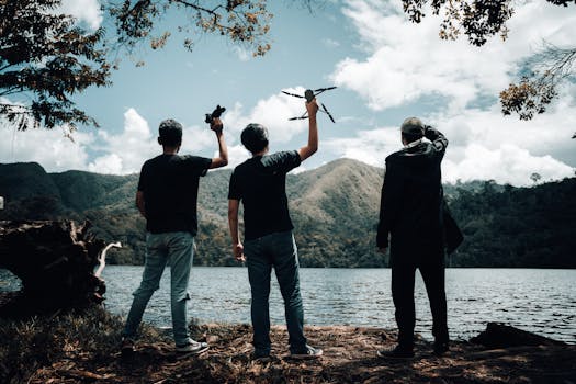
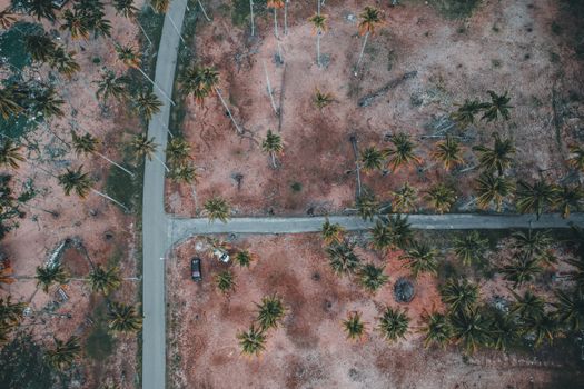
The wind whipped around me, threatening to snatch my drone right from my grasp. My heart pounded, a mix of fear and exhilaration. Below, the black sands of Reynisfjara stretched into the mist, waves crashing with a primal roar against the basalt columns. I took a deep breath, launched my trusty Mavic, and watched as it ascended, shrinking against the vast, dramatic canvas of Iceland. That moment, seeing the world unfold from a perspective previously reserved for birds, changed everything for me. It wasn't just a photo; it was an experience, a memory etched into my soul.
For us travel bloggers and photography enthusiasts at Tripsora, the drone isn't just a gadget; it's a magic carpet, a time machine, a portal to perspectives that simply aren't possible from the ground. It transforms landscapes you thought you knew into alien worlds, revealing patterns, scale, and beauty that take your breath away. But here’s the kicker: finding incredible drone locations that actually allow flying can be a maze of regulations, permits, and no-fly zones.
Fear not, fellow aerial adventurers! I’ve scoured the globe, navigated the red tape (and sometimes the actual red rocks), and compiled a bucket list of 7 absolutely mind-blowing drone photography locations where you can legally and responsibly unleash your bird. These aren't just places; they're experiences that will elevate your photography, inspire your wanderlust, and quite possibly, change your life. Get ready to bookmark, share, and start planning your next epic flight!
---
The Golden Rules of Responsible Drone Travel: Don't Be That Pilot
Before we dive into the destinations, let's talk essentials. As responsible drone pilots, we're ambassadors for the hobby. Following these rules ensures we keep these incredible places open for everyone (and avoid hefty fines or worse!).
- Know Before You Go (and Fly!): This is non-negotiable. Research national, regional, and local drone laws before you even pack your bags. Websites like DJI FlySafe, AirMap, or local aviation authority sites are your best friends. Some countries require registration (e.g., FAA in the USA), others require permits for commercial use, and some have blanket bans in national parks or near airports.
- Respect the Rules of the Air: Always fly within visual line of sight. Stay below maximum altitude limits (often 120m/400ft AGL). Never fly over crowds, private property without permission, or sensitive wildlife areas. No-fly zones (NFZs) are there for a reason – respect them.
- Weather or Not: Wind is your drone's arch-nemesis. Always check wind forecasts. Rain, snow, and extreme temperatures can damage your drone. My drone once got caught in an unexpected gust over the Scottish Highlands, and I nearly lost it! Always err on the side of caution.
- Battery Management is Key: Cold weather drains batteries faster. Always carry extra, charged batteries in fire-safe LiPo bags, especially for air travel. Remember, most airlines require batteries to be in your carry-on luggage.
- Privacy & Courtesy: Be mindful of people. Drones can be noisy and intrusive. If you see people, fly higher, farther away, or simply wait until they’ve moved on. A friendly wave and explanation can go a long way if someone seems curious or concerned.
- Wildlife First: Never harass or disturb wildlife. If your drone causes animals to change their behavior, land immediately. That epic shot isn't worth stressing an animal.
- Insurance: Accidents happen. Invest in drone insurance for peace of mind.
Got it? Good. Now, let’s explore those dream destinations!
---
1. Iceland's South Coast: Where Fire Meets Ice (and Drones Fly Free-ish)
Why it's incredible: Iceland is a drone pilot's paradise, a land of unparalleled dramatic beauty. The South Coast, in particular, offers a smorgasbord of otherworldly landscapes: massive waterfalls cascading into emerald valleys, black sand beaches pounded by furious Atlantic waves, colossal glaciers, and rugged volcanic formations. From above, the sheer scale and raw power of nature become breathtakingly apparent.
My experience: I'll never forget my first time flying over Skógafoss. From the ground, it's impressive. From 100 meters up, watching the river snake its way towards the falls, the tiny speck of people at its base, and the rainbow arching perfectly through the spray – it was pure magic. Later, at Reynisfjara, the basalt columns looked like giant organ pipes, and the patterns the waves created on the black sand were an abstract masterpiece. The wind, though, is always a factor here. I learned to hug the coastlines and keep a keen eye on my drone's wind resistance warnings.
Flying advice:
- Best Time: Golden hour (sunrise/sunset) paints the landscapes in incredible hues. Summer offers longer daylight, but winter provides stark, snowy drama.
- Specific Spots: Skógafoss, Seljalandsfoss (fly behind it!), Reynisfjara (be extremely careful of sneaker waves), the general area around Vík. Jökulsárlón Glacier Lagoon is stunning but often has restrictions due to tour boats and wildlife, so check local signs carefully.
- Regulations: Generally permissive outside national parks (like Vatnajökull) and specific restricted zones (e.g., near airports, some popular tourist sites). Always look for "No Drone" signs. Respect private property.
- Instagram-Worthy Shot: An aerial shot of Skógafoss with a rainbow, or the geometric patterns of the waves receding on Reynisfjara’s black sand.
- Travel Cost: Mid-range to expensive. Accommodation and food can add up quickly.
- Permits: Generally not required for recreational flying outside restricted zones, but always verify.
---
2. Norway's Lofoten Islands: Fjords, Fishing Villages, and Arctic Light
Why it's incredible: Imagine jagged, snow-capped peaks rising directly from the turquoise sea, interspersed with picturesque red fishing huts (rorbuer) and charming villages. The Lofoten Islands are a Nordic fairytale, and from a drone, they are simply unreal. The contrast of the dramatic mountains, the vibrant water, and the colorful architecture is a photographer's dream.
My experience: Flying my drone over Hamnøy, watching it slowly ascend above the iconic red rorbuer, with the colossal mountains of Sakrisøy and Reine in the background, was an emotional experience. The silence, broken only by the whirring of my props, allowed me to truly absorb the immense beauty. I got a shot of a lone kayak paddling through the glassy fjord, dwarfed by the landscape – a perfect capture of human scale against nature's grandeur. The light here, especially during the midnight sun or the short winter days, is incredibly soft and ethereal.
Flying advice:
- Best Time: Summer for long days and milder weather, or late autumn/winter for dramatic light, snow, and potential Northern Lights (though flying a drone in freezing temps and strong winds is challenging).
- Specific Spots: Reine, Hamnøy, Nusfjord, Å, and the various fjords. The beaches like Haukland and Uttakleiv also offer incredible coastal perspectives.
- Regulations: Norway generally allows recreational drone flying with standard rules (under 120m, line of sight, away from airports/military). Check local signs, especially near popular tourist viewpoints or protected areas.
- Instagram-Worthy Shot: A wide-angle aerial of a red rorbu village nestled against a towering fjord, perhaps with a boat leaving a wake.
- Travel Cost: Can be expensive, especially for accommodation and activities. Budget for ferry travel if island hopping.
- Permits: Not typically required for recreational flying.
---
3. Patagonia (El Chaltén Region, Argentina): Giants of the South
Why it's incredible: Patagonia is a land of legends, and its towering granite spires, vast glaciers, and turquoise lakes are epic from any angle. But from the air, the sheer, overwhelming scale of peaks like Fitz Roy and Cerro Torre truly becomes apparent. The interplay of light and shadow on these geological masterpieces is constantly changing, offering endless photographic opportunities.
My experience: Getting to El Chaltén felt like reaching the end of the world. The winds here are notorious, and I had to pick my flying windows carefully. One morning, before sunrise, I launched my drone near Laguna Capri, just outside the main national park boundary (where drones are restricted). Watching the first rays of sun hit the jagged peaks of Fitz Roy, painting them in fiery oranges and pinks, was a moment of pure awe. My drone, a tiny insect against the giants, captured the raw, untamed wilderness in a way no ground shot ever could. I felt like I was witnessing the birth of the world.
Flying advice:
- Best Time: Austral summer (December to March) for the best weather, though wind is always a factor. Shoulder seasons (November, April) offer fewer crowds and beautiful colors.
- Specific Spots: Crucial Note: Los Glaciares National Park (where Fitz Roy and Cerro Torre are) does not allow drone flying. However, excellent drone opportunities exist in the surrounding areas, on public land outside the park boundaries around El Chaltén. Always verify specific regulations on site. Look for areas with vast, open landscapes and no immediate park signs.
- Regulations: Argentina has regulations, and national parks are generally no-fly zones. Always check local signs and err on the side of caution. Focus on public lands outside park boundaries.
- Instagram-Worthy Shot: An aerial perspective of the Fitz Roy massif, with the winding Rio de las Vueltas or a glacial lake in the foreground.
- Travel Cost: Mid-range to expensive. Flights to Patagonia can be costly, but once there, hiking is free.
- Permits: Not for recreational flying in permitted areas, but strict adherence to national park rules is paramount.
---
4. The Dolomites, Italy: Alpine Majesty and Emerald Meadows
Why it's incredible: The Dolomites are a UNESCO World Heritage site, a range of impossibly dramatic limestone peaks, lush alpine meadows, and charming mountain villages. From above, the unique geological formations – the sheer, light-catching faces and the deep, winding valleys – are simply breathtaking. The interplay of light and shadow, especially during sunrise and sunset, creates a dynamic canvas.
My experience: I woke before dawn, hiked up towards Seceda, and launched my drone as the first light kissed the famous jagged ridges. The drone ascended, revealing the iconic "shark fin" peaks, with the rolling green pastures of Alpe di Siusi stretching out below. It was like a scene from a fantasy movie. The sheer verticality of the mountains, combined with the gentle curves of the meadows, made for an unforgettable composition. I even managed to capture a lone cow grazing, a tiny speck against the grandeur.
Flying advice:
- Best Time: Summer for vibrant green meadows and wildflowers, or autumn for stunning golden larch forests. Winter offers snowy landscapes but colder, potentially windier conditions.
- Specific Spots: Seceda, Alpe di Siusi (one of Europe’s largest high-altitude alpine meadows), Val di Funes (for the iconic church shots with mountains behind). Note: Tre Cime di Lavaredo is within a national park and has drone restrictions. Focus on areas like Seceda and Alpe di Siusi, but always check local signage.
- Regulations: Italy has drone regulations, including registration for drones over 250g. Local municipalities and protected areas may have specific rules. Always check current ENAC (Italian Civil Aviation Authority) guidelines and local signs.
- Instagram-Worthy Shot: The iconic jagged peaks of Seceda, with the rolling green meadows below, captured during golden hour.
- Travel Cost: Mid-range. Accommodation varies from budget-friendly guesthouses to luxury hotels.
- Permits: Not typically required for recreational flying if adhering to national regulations and local rules.
---
5. Scottish Highlands & Isle of Skye: Mystical Landscapes and Ancient Magic
Why it's incredible: The Scottish Highlands and the Isle of Skye are lands steeped in myth and legend, where ancient landscapes meet dramatic coastlines. From above, the vast, empty moors, the winding lochs, the towering rock formations, and the dramatic sea cliffs reveal a raw, untamed beauty. The ever-changing light and atmospheric mist make for incredibly moody and evocative aerial shots.
My experience: The weather on Skye is famously fickle. One moment, it was misty and drizzly; the next, the clouds parted, revealing a sliver of sunlight. I quickly launched my drone near the Old Man of Storr. As it climbed, the famous pinnacle emerged from the swirling mist, looking like a giant guardian. The scale of the landscape, with the patchwork of green and brown, and the distant sea, was absolutely mesmerizing. I also loved flying over the Fairy Pools, capturing the turquoise waters snaking through the rocky terrain. Just be prepared for strong winds!
Flying advice:
- Best Time: Late spring to early autumn for milder weather, but be prepared for rain and wind at any time. The dramatic light of autumn can be stunning.
- Specific Spots: Old Man of Storr, Quiraing, Fairy Pools, Kilt Rock (Isle of Skye). Glencoe and Loch Ness (Highlands) also offer incredible opportunities. Always be mindful of sheep and other livestock.
- Regulations: UK drone regulations apply (CASA). Generally permissive in open, unpopulated areas, but strict rules around airports, towns, and certain private estates. Always check for local signage, especially near popular tourist sites or nature reserves.
- Instagram-Worthy Shot: The Old Man of Storr or the Quiraing, captured from an elevated perspective as mist swirls around the peaks.
- Travel Cost: Mid-range. Accommodation can be booked up quickly, especially on Skye.
- Permits: Not required for recreational flying in permitted areas.
---
6. Moab, Utah (BLM Lands): Red Rock Canyons and Desert Dreams
Why it's incredible: Moab is synonymous with adventure and breathtaking red rock landscapes. While Arches and Canyonlands National Parks are strict no-drone zones, the vast surrounding Bureau of Land Management (BLM) lands offer incredible, legally permissible drone opportunities. From above, the sheer scale of the canyons, the winding rivers, and the unique geological formations create a stunning tapestry of color and texture.
My experience: I spent a glorious afternoon flying my drone near Fisher Towers, just outside Moab. The towers themselves are immense, but from my drone's perspective, I could capture the intricate patterns of erosion, the deep shadows, and the vast expanse of the desert stretching to the horizon. It felt like I was flying over Mars. The contrast of the deep red rock against the impossibly blue sky was a photographer's dream. Just remember, these desert environments can be harsh – extreme heat and dust are real concerns.
Flying advice:
- Best Time: Spring and Fall offer the most pleasant temperatures. Summer can be brutally hot, and winter can be cold. Golden hour is magical for highlighting the red rocks.
- Specific Spots: Crucial Note: NO DRONES IN NATIONAL PARKS (Arches, Canyonlands). Focus on the vast BLM lands surrounding Moab. Popular areas include Fisher Towers, Corona Arch Trail (check specific regulations for the trail itself, but surrounding BLM land is generally okay), and the scenic byways. Always double-check current BLM regulations for specific areas.
- Regulations: USA FAA rules apply. Strict no-fly zones over National Parks and other protected areas. Always use drone apps (B4UFLY) to check airspace. BLM lands are generally permissive for recreational flying if not otherwise restricted.
- Instagram-Worthy Shot: A sweeping aerial panorama of the Fisher Towers or a similar red rock formation, showcasing the vastness of the desert landscape.
- Travel Cost: Mid-range. Accommodation and activities can be pricey during peak season.
- Permits: Not for recreational flying on BLM land, but commercial use may require specific permits.
---
Your Next Flight Awaits!
There you have it – six incredible destinations where you can legally and responsibly unleash your drone and capture images that will truly stand out. From the dramatic coasts of Iceland to the mystical Highlands of Scotland, and the ancient red rocks of Utah, each location offers a unique perspective that only a drone can provide.
These aren't just places to visit; they're experiences to be lived, documented, and shared. So, charge those batteries, pack your drone, and get ready to see the world from a whole new angle. Remember to fly safe, fly smart, and always respect the environment and local regulations.
Which of these drone photography locations are you adding to your bucket list first? Have you flown your drone somewhere epic that allows flying? Share your stories and tips in the comments below! Let's inspire each other to explore the world, one breathtaking aerial shot at a time.