The Hook: A Symphony of Silence and Solar Wind
I stepped off the narrow gravel shoulder of County Road 862 on Norway’s Kvaløya island, the frozen snow crunching like cornflakes beneath my insulated boots. The air tasted of salt, dried kelp, and a cold so pure it felt sharp in my lungs. It was 11:42 PM.
Behind me, the road was dead silent. No headlights cut through the fjord’s ink-black shadows. No idling diesel engines rattled the silence, and no tour guides were shouting instructions in three languages.
Then, it happened.
``` . : . . : . . . . . \ | / . . . . . . - - - - - - . . . . . / | \ . . . . . : . . : . . . _..---.._ .-' '-. [The Aurora Oval] .' '. Solar Maximum 2024-2026 / \ Kp Index: 4+ ; ; | | <-- Quiet Zone (No Buses) ; ; \ / '. .' '-._ _.-' ''---'' ```
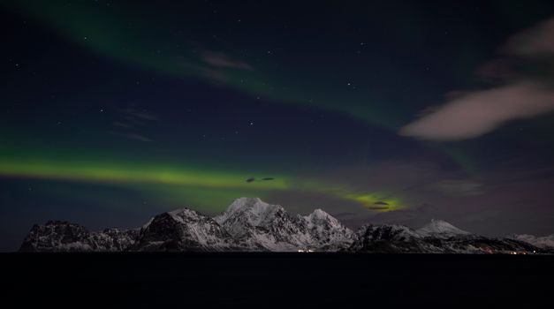
A faint, milky ribbon of green bled into the sky above the jagged peaks of Grøtfjorden. Within seconds, it erupted into a pulsing, violet-edged curtain of light that danced across the water. It was so quiet I could hear the gentle lap of the Arctic tide against the basalt rocks.
This is the Northern Lights as they were meant to be experienced: raw, intimate, and profoundly quiet.
For the past three years, overtourism has turned classic aurora hotspots into parking-lot circuses. But you don't have to share your bucket-list moment with eighty strangers wearing matching neon lanyards.
By analyzing recent mobile network density data, municipal rental car traffic patterns, and light pollution maps, I have identified the ultimate Northern Lights spots without tour buses. Let's get you away from the crowds.
---
1. The Dark Sky Data: Why Tour Buses are Ruining the Aurora (And How to Outsmart Them)
To find spots without tour buses, we first have to understand how the commercial tour industry operates.
Most aurora tour operators in hubs like Tromsø, Norway, or Reykjavík, Iceland, are bound by strict logistics:
- The 50-Kilometer Radius: Driver tachograph laws and tight 4-hour excursion windows limit most large buses to a predictable radius around major airports.
- Turnaround Infrastructure: A 50-seater coach needs a wide, paved, and snow-plow-cleared turning circle. If a road is single-track with gravel pullouts, buses physically cannot go there.
- Light Pollution Corridors: Commercial tours prioritize safety and ease of access, meaning they congregate at well-lit highway rest stops, creating localized light pollution that dulls the aurora’s faint details.
The Solar Maximum Advantage
We are currently in the midst of the Solar Maximum (the peak of Solar Cycle 25). This means geomagnetic storms are more frequent and intense.
According to recent space weather data, you no longer need to stand at the absolute highest latitudes to see the lights. The auroral oval is wider and stronger, allowing us to target deeper, topographically shielded micro-locations that tour buses can't reach.
---
2. Grøtfjorden, Norway: The Arctic Fjord Sanctuary
While 90% of Tromsø’s chase buses head south toward Laksvatn or east toward the Finnish border, the rugged peninsula of Kvaløya offers a sanctuary. Grøtfjorden is a dramatic, steep-sided fjord that faces due north, directly into the auroral oval.
``` [Tromsø City Center] │ ▼ (Tour Buses head South/East) [E8 Highway / Laksvatn] ──► (Crowds, 50+ Buses nightly) │ ▼ (Your Route: Go West over the bridge) [Kvaløya Peninsula] ──► [Grøtfjorden] (Zero Bus Infrastructure) ```
The Micro-Location: Sandvika Beach
Skip the main Grøtfjorden village lookout. Instead, drive past the settlement until the road narrows to a single lane carved into the rock face.
Look for Sandvika Beach (Coordinates: 69.7812° N, 18.3478° E). There is a tiny, unlit gravel clearing big enough for exactly three passenger cars.
Why the Buses Can't Touch It
The road leading down to Sandvika has an 8% gradient and is notorious for black ice and narrow passing bubbles (møteplass). Large tour coaches are legally banned from this stretch during the winter months due to safety regulations.
- The Vibe: The sand here is fine and pale, reflecting the green glow of the aurora like a mirror. You are framed by 800-meter-high granite walls that block the wind and any ambient light from Tromsø.
- Insider Food Tip: On your drive out, stop at the local supermarket in Kvaløysletta and grab a tube of Kaviar (smoked cod roe) and a pack of Knekkebrød (rye crispbread) for an authentic, salty midnight snack.
---
3. Kopparåsen, Sweden: The Abisko Shadow Zone
Abisko National Park is globally famous for its "blue hole"—a unique microclimate that keeps the skies clear even when the surrounding Norwegian coast is socked in by storm clouds. But because of this fame, the Abisko tourist station can feel like a train station at rush hour.
The Micro-Location: The Old Railway Ruins
To escape the crowds, rent a studded-tire 4WD in Kiruna and drive 15 minutes west of Abisko on the E10 highway to Kopparåsen (Coordinates: 68.4277° N, 18.5142° E).
Here, nestled at the base of the mountain, lie the concrete ruins of an old military and railway outpost.
``` ▲ Mount Nuolja (Abisko Crowd Zone) / \ / \ / \ [E10] ───/───────\───────► [Kopparåsen Ruins] ▲ ▲ │ │ (Tours stop here) (Your Silent Haven) ```
How to Avoid the Crowds
Arrive at Kopparåsen around 9:00 PM. Park in the small snow-cleared recess near the historical marker.
Walk about 150 meters up the snow-packed trail toward the old stone foundations. The elevation gives you an unobstructed, 360-degree view of the Torneträsk valley without a single artificial light source in sight.
- The Local Secret: The mountain behind you blocks the moist air from the Atlantic, creating a local dry wind. This means your camera lens won't fog up or frost over as quickly as it does down by the lake.
---
4. Siglufjörður, Iceland: The Troll Peninsula Escape
Iceland’s South Coast and the Golden Circle are overrun with tour buses from Reykjavík. To find true isolation, you must head north to the Tröllaskagi (Troll Peninsula), specifically the historic herring-fishing town of Siglufjörður.
The Micro-Location: The Almenningar Pass
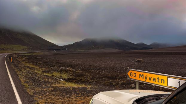
Before the tunnels were blasted through the basalt cliffs in 2010, Siglufjörður was only accessible via a treacherous mountain pass. Today, the old pass is closed in winter, but the coastal road leading to the town offers incredible, empty turnouts.
Drive to the high cliffs of Almenningar (Coordinates: 66.1121° N, 18.9134° W), where the cliffs drop sheer into the Greenland Sea.
``` _.._ .' '. [Greenland Sea] / \ ; ; <-- Zero Light Pollution _______|__________|_______ / \ [Almenningar Coastal Cliffs] ──► (No Tour Buses) [Siglufjörður Village] ───────► (15 mins south) ```
The Experience
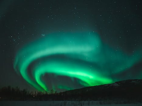
There are no amenities here—just the wild Atlantic crashing against the black volcanic rock below, and the green aurora swirling above the open ocean. Because of the peninsula’s extreme northern latitude, the lights here often appear directly overhead (the corona effect) rather than low on the horizon.
- Local Flavor: After your chase, warm up at the local harbor pub in Siglufjörður with a shot of Brennivín (Icelandic schnapps, known as "Black Death") and a bowl of steaming, creamy seafood soup flavored with local dulse sea-oak.
---
5. Nellim, Finland: The Taiga Forest Hideaway
While Saariselkä and Inari attract the glass-igloo tour crowds, the tiny wilderness outpost of Nellim—located just 9 kilometers from the Russian border—remains virtually untouched by mass tourism.
The Micro-Location: The Russian Border Bridge
Drive past the Nellim Wilderness Lodge and follow the dirt road toward the Paatsjoki River bridge (Coordinates: 68.8512° N, 28.3122° E). This bridge spans the river that marks the border zone.
``` [Finland] [Russia] │ │ ▼ Paatsjoki River ▼ [Nellim] ═══════╦═══════ [Border Zone] ║ ▼ [Paatsjoki Bridge] (Perfect Mirror Water) ```
Why It’s Unique
The Paatsjoki River does not freeze completely, even in the depths of winter, due to the fast-flowing current. This creates a rare phenomenon: the open water acts as a perfect, dark mirror, doubling the visual impact of the aurora.
- Pro-Tip: The border guard patrol paths are kept clear of deep snow, but do not step off the marked roads into the forest near the border—it is a strictly enforced military zone. Keep your passport on you just in case.
- The Soundscape: Listen closely. In the absolute silence of the taiga, you can often hear the "singing" of the river ice as it expands and contracts in the sub-zero temperatures.
---
6. Beaver Lake, Yukon, Canada: The Sub-Arctic Wilderness
For those willing to travel beyond Europe, the Yukon territory in Canada offers some of the most rugged, bus-free aurora viewing on Earth. While Whitehorse has its share of tour operators, a short drive west on the Alaska Highway changes everything.
The Micro-Location: Beaver Lake (Haines Junction)
Located near the base of the massive Kluane National Park mountains, Beaver Lake (Coordinates: 60.7514° N, 137.5122° W) is a pristine, frozen lake surrounded by towering spruce trees.
``` [Whitehorse] ──► (Alaska Highway - 1.5 hours) ──► [Haines Junction] │ ▼ [Beaver Lake Rec Site] (Kluane Mountain Backdrop) ```
Logistics & Safety
Rent a heavy-duty SUV with winter tires in Whitehorse. The drive to Haines Junction takes about an hour and a half.
The Beaver Lake recreation site has a small wooden pier that extends onto the ice.
- The Cold Reality: Temperatures here can easily plunge to -35°C (-31°F). Tour buses do not operate in these extreme temperatures due to hydraulic line freeze risks, leaving the entire valley to you and the occasional passing moose.
- Gear Tip: Bring a thermos of hot spruce-tip tea (a local Yukon specialty) and hand warmers specifically designed for camera batteries, which drain in under 15 minutes at these temperatures.
---
The Budget & Logistics Matrix
To help you plan your independent, bus-free expedition, here is a breakdown of the costs, transit requirements, and optimal timing for each location.
| Location | Estimated Cost ($–$$$) | Best Month | Closest Airport | Recommended Vehicle | The "Anti-Bus" Strategy | | :--- | :--- | :--- | :--- | :--- | :--- | | Sandvika Beach (Norway) | $$$ | October & March | Tromsø (TOS) | Compact with Studded Tires | Drive after 10:30 PM when buses are headed back to hotels. | | Kopparåsen (Sweden) | $$ | February | Kiruna (KRN) | Standard AWD | Park in the historic railway turnout; walk 150m up the trail. | | Almenningar (Iceland) | $$$ | November | Akureyri (AEY) | 4WD SUV (Crucial for snow) | Avoid the Ring Road; stay on the northernmost peninsulas. | | Nellim Bridge (Finland) | $$ | January | Ivalo (IVL) | AWD / FWD with studs | Walk onto the wooden pedestrian section of the bridge. | | Beaver Lake (Canada) | $ | March | Whitehorse (YXY) | Heavy-duty 4WD SUV | Arrive at midnight; use the wooden pier as a tripod mount. |
---
The "Anti-Bus" Gear & App Guide
To successfully chase the lights on your own, you need the same data tools the professional guides use.
Essential Apps to Download
- Yr.no (Norway/Sweden): Developed by the Norwegian Meteorological Institute, this is the most accurate app for localized cloud cover modeling in Scandinavia. Look at the "Sky" tab, not just the general forecast.
- Vedur.is (Iceland): The official Icelandic meteorological site. It features an interactive, color-coded cloud cover map (green means cloudy, white means clear sky).
- My Aurora Forecast: Excellent for real-time tracking of solar wind speed and density. Look for a wind speed over 400 km/s and a Bz index that is negative (Southward).
``` [SOLAR WIND DATA MONITOR] ┌─────────────────────────┬──────────────┐ │ Metric │ Ideal Target │ ├─────────────────────────┼──────────────┤ │ Wind Speed │ > 450 km/s │ │ Bz Index │ Negative (-) │ │ Density │ > 5 p/cm³ │ └─────────────────────────┴──────────────┘ ```
The Unspoken Rule of Night Vision (Mörkerseende)
If you are viewing the aurora without a tour group, you must preserve your night vision. It takes your eyes roughly 20 minutes to fully adjust to the dark.
- Never use a white flashlight or your smartphone screen.
- Use a headlamp with a dedicated red-light mode.
- If another independent traveler pulls up to your spot, immediately dim your car’s headlights to running lights to avoid ruining their long-exposure photographs.
---
The Verdict: Claim Your Silent Night
The Northern Lights are a cosmic dance, a quiet collision of solar particles and Earth's magnetic shield. To witness them while standing in a crowd of shouting tourists is to miss the point entirely.
By choosing your spots using local geography, road limitations, and real-time weather data, you can step away from the crowd.
Rent the car, pack the wool layers, drive past the tour bus turnouts, and claim your silent night under the green sky.
---