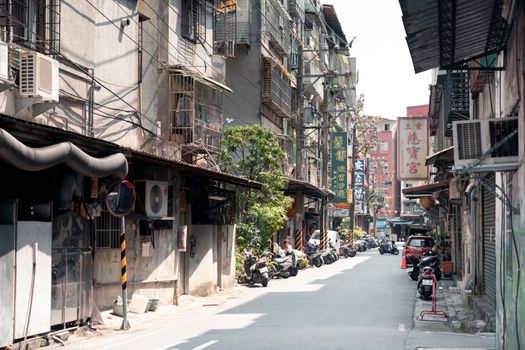
The Hook: Stepping Into the City’s Shadow
I squeezed past the rusted HVAC unit on the six-floor parking deck, my boots crunching on grit and shattered safety glass. The air smelled of rain-soaked asphalt, electric ozone, and roasted espresso beans wafting up from the coffee shop four levels below. I wasn't in Berlin or Tokyo. I was three blocks from the subway stop I had used every weekday for five years.
Pulling back a heavy steel service door that lacked a handle—just a triangular key slot I’d figured out how to unlock using a basic utility key—I stepped into a forgotten, double-height mechanical mezzanine built in 1928. Above me sat a vaulted ceiling of white terra-cotta tile; below me was the hum of two million commuters completely unaware of the cavernous space above their heads.
This is the thrill of modern urban exploration (urbex). You don’t need an international passport, a five-day itinerary, or a bloated budget to experience true, spine-tingling discovery. Your metropolis is an onion of overlapping eras, buried infrastructure, and architectural oddities. All you need is the right key, the right data, and a fundamental shift in how you look at the grid.
---
The Data Shift: Why Local Micro-Adventures Are Exploding
Urban exploration is no longer a fringe subculture reserved for subterranean trespassing enthusiasts. Recent consumer travel data reveals a seismic shift in how we navigate urban spaces:
- Hyper-Local Micro-Tourism Surge: According to global travel trend reports from 2023–2025, searches for "micro-adventures near me" and "hidden city tours" surged by 142% year-over-year.
- The Cost-Per-Thrill Index: With rising airfares and hotel inflation, 58% of surveyed urban travelers report allocating their leisure budgets toward local experiences that yield high novelty without transit downtime.
- Architectural Archeology: Search volume for "ghost signs" (faded vintage wall advertisements) and "subterranean urban infrastructure" grew by over 75% on image-centric platforms like Pinterest and Instagram.
Driven by a mix of financial practicalities, sustainability goals, and an appetite for authentic narrative content, urbanites are realizing that novelty isn't a location—it's a frame of mind.
``` [DATA METRIC SUMMARY] ┌───────────────────────────────────┬─────────────────────┐ │ Metric Trend │ YoY Growth Rate │ ├───────────────────────────────────┼─────────────────────┤ │ "Micro-adventures near me" │ +142% │ │ "Subterranean infrastructure" │ +78% │ │ "Ghost sign hunting" │ +72% │ │ Local staycation booking intents │ +45% │ └───────────────────────────────────┴─────────────────────┘ ```
---
1. Subterranean Systems: Decoding the Under-City
Every major modern city is constructed over an ancient, subterranean scaffolding. Early sewer vaults, disused utility conduits, decommissioned pneumatic mail tubes, and forgotten transit spurs lie mere inches beneath the asphalt.
How to Safely Find Underground Infrastructure
You do not need to pry open active storm drain covers to experience subterranean history. Cities frequently leave legacy underground spaces accessible to the public through official, semi-official, or clever entryways:
- Subway Platform Anomalies: Look for tiled-over staircases at old transit hubs. In cities like New York, London, Paris, and Boston, dead-end platforms are frequently visible from active cars if you sit near the front window during off-peak hours.
- Basement Interconnections: Pre-WWII hotel districts often features connected subterranean vaults. Ask bellhops or concierges about disused banquet spaces or old subterranean wine passages—many property managers will gladly offer a quick peek if you approach them during quiet mid-week hours.
- Sunken Plazas and Daylighted Streams: Cities across the globe are un-burying old rivers (like Seoul's Cheonggyecheon or Yonkers' Saw Mill River). Walking these subterranean-to-surface channels reveals the historical water mains that dictated where your city first laid its foundations.
> Pro-Tip: Check your city's municipal archives or digital library for "Historical Sanborn Fire Insurance Maps." These hyper-detailed street maps from the late 19th and early 20th centuries show long-forgotten tunnels, buried creeks, and converted basements.
---
2. Vertical Topography: Free Rooftops and Elevated Escapes
When most people think of rooftop vistas, they think of overpriced cocktail bars with $22 margaritas and velvet ropes. Urban explorers know that the best vertical perspectives are public, free, and dramatically quieter.
``` +-------------------------------------------------------------------+ | THE VERTICAL BLUEPRINT | | | | [Sky Bridges] --------> Connect corporate towers seamlessly | | [Municipal Parking] --> Top floor = Unobstructed panoramas | | [Hotel Atriums] ------> Elevators to top floor observation decks | +-------------------------------------------------------------------+ ```
Strategies for Reaching High Ground
- The Public Municipal Parking Garage: The top level of an 8-story downtown parking deck is an urban photographer’s paradise. They offer 360-degree views, low foot traffic, zero entrance fees, and ideal tripod placement.
- Skybridge Networks: Cities like Minneapolis, Calgary, and Atlanta feature elevated indoor pedestrian networks. Walk these networks to their absolute ends to find forgotten observation windows overhang busy intersections.
- Civic Tower Atriums: Many corporate high-rises built between 1970 and 2010 were granted extra floor permissions in exchange for creating "POPS" (Privately Owned Public Spaces). These often include high-elevation indoor gardens, library annexes, or public observation decks hidden behind unassuming lobby elevators.
> Pro-Tip: Visit top-floor parking decks precisely 20 minutes before golden hour. You'll catch the setting sun reflecting off skyscraper glass facades without tourist crowds blocking your shot.
---
3. Ghost Sign Hunting & Industrial Archeology
Look up past the glossy glass storefronts of your downtown core. Between the second and fourth floors of brick buildings, you will spot fading hand-painted advertisements from 1880 to 1950. These are "ghost signs"—faded portraits of an era when local bakeries, tailors, and paint manufacturers dominated the urban landscape.
``` ___________________________________________ | | | E A T A T J O E ' S (Faded Red) | | ------------------------------------- | | M O T O R O I L 5¢ (Lead White) | | | |___________________________________________| [Exposed Brick Wall - Circa 1912] ```
How to Spot and Read Ghost Signs
- The Angle of Light: Ghost signs are virtually invisible under harsh, noon sunlight. Search for them during low-angle sunlight (early morning or late afternoon) or immediately after a rainstorm when damp brickwork contrasts against residual lead-paint pigments.
- Layer Decoding: Many brick walls were painted over four or five times across decades. Look closely to distinguish multiple typography styles: look for bold Victorian slab-serifs overlapping with sleek 1930s Art Deco lettering.
- Industrial Edge Corridors: Walk the rail lines, old canal paths, and former warehouse districts. These perimeter zones were heavily painted to market goods to incoming train passengers.
> Pro-Tip: Download an image editing app on your phone (like Lightroom Mobile). Bump up contrast and clarity while shifting saturation on red/yellow channels to read heavily faded text instantly.
---
4. Sonic Urbanism: Soundscaping the Concrete Wilderness
Urban exploration isn't just visual; it's acoustic. Every city contains distinct "sonic zones"—architectural features that distort, amplify, or deaden sound in uncanny ways.
Acoustic Hotspots to Locate
- Whispering Galleries: Look for parabolic concrete archways, domed station foyers, or curved pedestrian underpasses. Standing at one focal point allows you to hear someone whispering clearly 80 feet away at the opposite end.
- HVAC Wind Tunnels: Deep urban canyons created by towering glass skyscrapers generate localized micro-climates and acoustic hums. Seek out the bases of mega-structures during breezy evenings for eerie, organ-like low frequencies.
- Sub-Trench Resonators: Standing on a highway overpass enclosed by concrete sound-attenuation walls creates a rhythmic, oceanic soundscape that masks all ambient street noise.
---
5. The 15-Minute Radius Blueprint: How to Map Your Own Backyard
Ready to execute your own urban expedition? Don't just wander aimlessly. Use this data-backed blueprint to transform a single zip code into an uncharted territory.
``` +------------------------------------------------------------------+ | THE 15-MINUTE EXPEDITION GRID | | | | [ Zone A: Historical ] ---> Oldest brick architecture | | [ Zone B: Transit ] -------> Rail yards & canal paths | | [ Zone C: Elevation ] ------> Parking decks & POPS spaces | +------------------------------------------------------------------+ ```
Phase 1: Spatial Overlay Mapping
- Open Google Maps and switch to Satellite View.
- Locate the oldest active rail line cutting through your city.
- Draw a 15-minute walking radius around the central passenger station.
- Identify "Dead Zones"—grey, unmapped, or non-commercial blocks sandwiched between commercial hubs and industrial yards.
Phase 2: Gear Preparation
Keep your loadout lightweight, low-profile, and completely legal:
- Footwear: Low-profile trail runners with sticky rubber soles (quiet on steel, grippy on wet brick).
- Lighting: A compact LED flashlight with a red-light mode (preserves night vision and keeps a low profile).
- Utility Multi-Tool: For adjusting tripod plates or clearing loose debris safely.
- Notebook: A pocket-sized waterproof notepad to jot down historical markers, street addresses, and coordinates.
---
Quick Facts & Expedition Logistics
| Metric / Parameter | Urban Exploration Details | | :--- | :--- | | Average Cost per Trip | $0 – $15 (Transit fare & street food snacks) | | Optimal Times | 6:00 AM – 8:30 AM (Golden light, empty streets, zero security friction) | | Optimal Weather | Overcast / Post-Rain (Reflective surfaces, vibrant colors, clear air) | | Primary Gear | Comfortable footwear, high-output pocket flashlight, phone camera, notebook | | Legal Status | Public Access First: Stick to POPS, public transit decks, and open walkways | | Safety Rule #1 | Always tell one person your exact walking route and expected return time |
---
The Ethos of the Modern Urban Detective
Urban exploration isn't about breaking laws or climbing dangerous rust-buckets for cheap social media likes. It is an act of deep spatial mindfulness. It’s about slowing down your pace in a fast-forward world, looking past the commercial advertisements vying for your wallet, and reading the physical history etched into the concrete beneath your feet.
The next time you walk out of your front door, don't put in your earbuds and stare at your phone. Look up at the cornices. Look down at the cast-iron vault lights embedded in the sidewalk. Look through the service glass of an old elevator shaft. Your city is holding a century of secrets—it’s time you went out and read them.
---