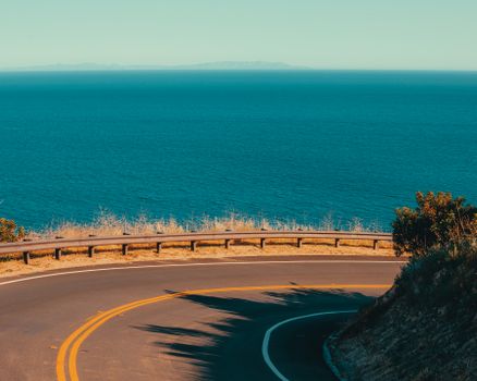
A road trip from San Francisco to Los Angeles can take as little as six hours on the inland freeway or span four to five days of unhurried exploration down the Pacific coast. For travelers who simply need to get from northern to southern California, the inland corridors offer speed and efficiency. However, taking the scenic coastal route along California State Route 1 (Highway 1) and US Route 101 turns a standard transfer into one of the premier driving experiences in North America. We recommend taking at least three to four days to make the drive comfortably while leaving time to stop at historic coastal towns, marine reserves, and scenic viewpoints along the way.
Route options: fastest vs scenic
Drivers traveling between San Francisco and Los Angeles have three primary route choices. Each serves a different balance of travel time and scenery.
The inland route: Interstate 5 (fastest)
Interstate 5 runs directly down the Central Valley. The driving distance is roughly 380 miles (about 610 km), and the drive takes approximately 5.5 to 6.5 hours depending on traffic exiting the Bay Area and entering the Los Angeles basin. This is an efficient transit route through flat agricultural land, but it offers little in terms of tourism or coastal scenery. Services are plentiful at major highway junctions, though heavy commercial truck traffic is common.
The middle route: US-101 via Paso Robles
US Route 101 offers a balanced compromise between speed and scenery. Covering roughly 430 miles (about 690 km), this route takes around 7 to 8 hours of total driving time. It routes travelers south through the Salinas Valley, the rolling hills and vineyards of Paso Robles, and joins the coast near Pismo Beach before continuing down through Santa Barbara. This route remains open year-round and bypasses the narrow, winding cliffside sections of Highway 1 while still delivering pleasant rural and coastal views.
The coastal route: Highway 1 and US-101 (scenic)
The classic coastal drive follows Highway 1 through Monterey, Big Sur, and San Luis Obispo County before merging with US-101 through Santa Barbara and into Los Angeles. This route covers approximately 450 to 480 miles (about 720 to 770 km). Without stops, pure driving time along the coast is roughly 10 to 12 hours due to lower speed limits, sharp turns, and single-lane stretches. Because of the slow pace and sheer number of points of interest, this route should be divided across several days.
How many days to take and suggested day-by-day plan
While an ambitious driver can complete the coastal route in two long days, a three- to four-day itinerary provides a far better rhythm. It allows you to walk along the bluffs, explore state parks, and arrive at your evening destination before nightfall.
Suggested 4-day itinerary
- Day 1: San Francisco to Monterey (approx. 120 miles / 195 km, 2.5 to 3 hours driving). Leave San Francisco via Highway 1 south through Pacifica and Half Moon Bay. Stop at Santa Cruz to see the historic beach boardwalk, then continue around the bay into Monterey. Spend the afternoon walking through Cannery Row, visiting the Monterey Bay Aquarium, or driving the 17-Mile Drive around Pebble Beach to Carmel-by-the-Sea.
- Day 2: Monterey to Cambria or Morro Bay (approx. 100 to 115 miles / 160 to 185 km, 3 to 4 hours driving). Drive south past Carmel Highlands into Big Sur. Stop to view the historic Bixby Creek Bridge and take a short walk in Pfeiffer Big Sur State Park. Continue south along the rugged bluffs to San Simeon to view the Piedras Blancas elephant seal colony before settling into Cambria or Morro Bay for the night.
- Day 3: Morro Bay to Santa Barbara (approx. 110 to 120 miles / 175 to 195 km, 2 to 2.5 hours driving). Head inland toward San Luis Obispo, then re-encounter the Pacific near Pismo Beach. Continue south through the Santa Ynez Valley, with an optional detour to the Danish-inspired town of Solvang. End the day in Santa Barbara, known for its Spanish Colonial architecture, palm-lined waterfront, and lively downtown dining scene.
- Day 4: Santa Barbara to Los Angeles (approx. 95 miles / 150 km, 2 to 3 hours driving). Follow US-101 south past Ventura toward Malibu. Enjoy views of surfers along Point Dume and Zuma Beach before entering the Los Angeles area via Santa Monica and the Pacific Coast Highway. Allow extra time for afternoon traffic as you approach the Los Angeles metropolitan area.
Top stops along the Pacific Coast Highway
When following the coastal corridor, several landmark locations and natural sights stand out as essential stops:
- Half Moon Bay and Pigeon Point: Located south of San Francisco, this stretch features working farmland on one side and dramatic ocean cliffs on the other. Pigeon Point Light Station offers panoramic ocean viewpoints.
- Monterey and Carmel-by-the-Sea: Monterey provides maritime history, coastal walking trails, and marine research facilities. Neighboring Carmel-by-the-Sea features fairytale-style architecture, art galleries, and a white-sand beach.
- Bixby Creek Bridge: Completed in 1932, this concrete arch bridge spans a deep coastal canyon and remains one of the most recognized highway landmarks in the world. Designated turnouts on the north side allow travelers to take photos safely off the roadway.
- Julia Pfeiffer Burns State Park: Known for McWay Falls, where a freshwater stream drops 80 feet directly onto the sands of a tidal cove.
- Piedras Blancas Elephant Seal Rookery: Located just north of San Simeon, this free public viewing area features boardwalks overlooking thousands of northern elephant seals hauled out on the sand.
- Morro Rock: A massive volcanic plug that rises directly from the Pacific at the entrance to Morro Bay Harbor, surrounded by active sea otters and coastal birds.
- Santa Barbara: Known as the American Riviera, this city offers historic sites like the Old Mission Santa Barbara, the pedestrian-friendly State Street Promenade, and Stearns Wharf.
Where to stay overnight along the route
Choosing the right towns for overnight stays ensures manageable driving legs and access to dining and services.
- Monterey or Pacific Grove: Excellent for night one. Both provide easy access to coastal trails and restaurants while setting you up for an early morning departure into Big Sur.
- Cambria: A quiet coastal village set among Monterey pines, Cambria sits just south of the Big Sur cliffs and minutes from Hearst Castle, making it a peaceful midpoint.
- Morro Bay or San Luis Obispo: For more dining options and varied services, these two neighboring communities provide solid alternatives. San Luis Obispo offers a walkable downtown centered around an eighteenth-century mission, while Morro Bay offers working-harbor views.
- Santa Barbara: The ideal final overnight stop. Staying here lets you tackle the heavy Los Angeles traffic the following morning rather than arriving late at night after a full day of driving.
Best time of year to drive
The coastal drive is accessible year-round, but seasonal patterns affect road conditions and visibility:
- Autumn (September to November): Generally the best time for clear skies and pleasant weather. Summer coastal fogs dissipate, daytime temperatures are warm, and regional visitor numbers decrease after the summer holidays.
- Spring (April to May): Green hillsides and coastal wildflowers make spring visually appealing. Weather is typically mild, though lingering storms can occasionally cause late-season road maintenance.
- Summer (June to August): High season brings heavy road traffic and frequent morning fog, commonly referred to locally as "June Gloom." While mornings can be overcast and chilly, afternoons often clear up, especially away from the immediate coastline.
- Winter (December to March): Winter brings the highest rainfall to the Central Coast. Heavy winter rains can trigger mudslides or rockfalls along the steep terrain of Big Sur, sometimes leading to extended road closures.
Road conditions, tolls and parking
Driving the coastal corridor requires preparation for varied road types and city traffic patterns.
- Road conditions and closures: Highway 1 through Big Sur is carved into steep, active mountainsides prone to geological movement. Landslides regularly cause partial or total closures of Highway 1, sometimes requiring long detours via US-101. Always verify current conditions with official state transportation agencies before setting out.
- Tolls: Most rural highways between San Francisco and Los Angeles are toll-free. However, bridges leaving San Francisco (such as the Golden Gate Bridge and the San Francisco-Oakland Bay Bridge) use all-electronic toll collection. There are no cash toll booths; tolls are assessed via license plate readers and billed online or through your rental car agreement.
- Parking: Parking can be competitive at popular state parks, beaches, and scenic turnouts along Highway 1. Arriving early in the morning or later in the afternoon helps secure spaces. In towns like Monterey, Santa Barbara, and Santa Monica, public parking garages usually offer the most convenient paid parking.
Practical tips: fuel, electric vehicles and families
- Fuel planning: Services are sparse through Big Sur. A stretch of approximately 70 miles (110 km) has very few service stations, and the stations that do operate in remote areas charge significantly higher prices than average. Fill your tank completely in Monterey or Carmel before driving south, or in Cambria if driving north.
- Electric vehicle charging: Fast-charging corridors along US-101 and Interstate 5 are dense and reliable. While chargers exist in Monterey, Cambria, and Big Sur village, remote stretches along Highway 1 have limited high-speed charging infrastructure. Plan charging stops in advance and top up before entering rural coastal segments.
- Driving with children: The winding turns along Highway 1 between Carmel and San Simeon can cause motion sickness. Keep car sickness remedies on hand and schedule regular stops. Elephant seal viewing at Piedras Blancas and tide-pooling in Monterey provide natural breaks that appeal to young travelers.
Frequently asked questions
Can you drive from San Francisco to Los Angeles in one day?
Yes, you can easily drive between the two cities in a single day using Interstate 5, which takes about six hours of driving time. However, driving the scenic coastal route along Highway 1 in one day is not recommended, as it requires at least ten to twelve hours behind the wheel and leaves no time to explore the sights.
Which direction is best: north to south or south to north?
Driving from north to south (San Francisco to Los Angeles) is considered the preferred direction. In this direction, you drive in the southbound lane on the ocean side of the road, which provides unobstructed ocean views and easier access to coastal pullouts and scenic overlooks without needing to turn across oncoming traffic.
Is Highway 1 fully open all the time?
Highway 1 through Big Sur experiences periodic closures due to rockslides and unstable roadbeds, particularly after heavy winter rains. When sections of the highway are closed, through-travel between Monterey and Cambria is blocked, requiring drivers to use US-101 as an inland bypass. Always check official California Department of Transportation road advisories prior to your departure.