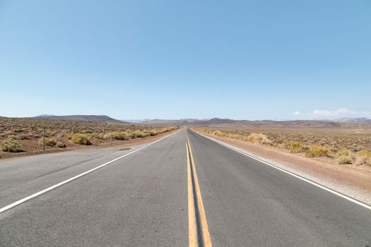
A straight drive from Los Angeles to Las Vegas takes roughly 4 to 5 hours under normal conditions, covering about 270 miles (435 km). However, weekend congestion can easily extend that time to 7 hours or more. If you have the flexibility, expanding the journey across 2 or 3 days transforms a standard interstate dash into a true desert road trip through historic roadside communities, Mojave Desert parks, and open vistas.
Route options: Direct drive versus scenic desert detours
Depending on your schedule and interest in desert scenery, you can choose between a fast interstate corridor or longer routes through California's southern deserts.
The direct route: Interstate 15 North
- Distance and driving time: Roughly 270 miles (435 km); about 4 to 5 hours without heavy traffic.
- Road characteristics: Interstate highway with multiple lanes, steep mountain grades, and services spaced every 30 to 50 miles (48 to 80 km).
Interstate 15 is the standard route between the two cities. Leaving the Los Angeles Basin, the highway climbs through the Cajon Pass before dropping into the High Desert of Victor Valley. From there, it cuts across vast desert basins through Barstow and Baker before crossing the Nevada state line at Primm. While fast and efficient, this corridor is prone to severe traffic bottlenecks on Friday afternoons heading north and Sunday afternoons heading south.
The southern scenic detour: Joshua Tree and Route 66
- Distance and driving time: Roughly 350 miles (563 km); about 7 to 8 hours of driving.
- Road characteristics: Two-lane desert highways, long stretches without mobile service, and classic sections of Historic Route 66.
This route branches east on Interstate 10 toward Joshua Tree National Park and the town of Twentynine Palms. From there, head north along Amboy Road to join a preserved section of Route 66, passing the Amboy Crater. Continue north across the southern edge of Mojave National Preserve via Kelbaker Road to reconnect with Interstate 15 at Baker. This route requires careful fuel management but rewards drivers with quiet desert landscapes.
The northern scenic detour: Death Valley National Park
- Distance and driving time: Roughly 420 miles (675 km); about 8 to 9 hours of driving.
- Road characteristics: Mountain passes, long desert valleys, two-lane rural highways, and extreme summer temperatures.
To bypass Interstate 15 entirely, take California State Route 14 north through Lancaster and Mojave, then connect with US Route 395 toward Lone Pine and California State Route 190. This takes you directly through Death Valley National Park, past Badwater Basin and Zabriskie Point, before exiting eastward toward Pahrump, Nevada, and into Las Vegas. This detour works best as a multi-day trip.
Top stops along the Interstate 15 corridor
If you stick to the main highway, several distinct roadside sights and towns break up the drive.
Victorville and the California Route 66 Museum
Victorville sits at the top of the Cajon Pass. It serves as an accessible introduction to the old highway era. The town features the California Route 66 Museum, which displays vintage vehicles, road signs, and memorabilia tracing the historic path from Chicago to Santa Monica. It provides a quick cultural stop before you enter the wide Mojave basin.
Barstow and Calico Ghost Town
Roughly 115 miles (185 km) into the drive, Barstow is the central junction between Los Angeles, Las Vegas, and the central valley. Just north of Barstow lies Calico Ghost Town, an 1880s silver-mining town restored as a county regional park. Visitors can walk among historical wooden storefronts, tour an old silver mine, and see the harsh desert terrain early miners navigated.
Baker and the World's Tallest Thermometer
Baker marks the final major service outpost in California before reaching the Nevada border. The town is famous for the World's Tallest Thermometer, a 134-foot-tall electric sign built to commemorate the record 134°F (57°C) temperature recorded in nearby Death Valley in 1913. Baker is also a major access point for the Kelso Dunes and cinder cones within the Mojave National Preserve.
Seven Magic Mountains
Located about 10 miles (16 km) south of Las Vegas near the town of Jean, Nevada, Seven Magic Mountains is a public art installation created by Swiss artist Ugo Rondinone. The installation features seven towers of stacked, brightly painted boulders standing against the muted desert backdrop of the Ivanpah Valley. It is accessible just off Interstate 15, with free parking available near the walking path.
Suggested itineraries: From a one-day sprint to a three-day journey
Depending on your travel goals, you can complete the journey in a single afternoon or spend several days exploring the desert.
The 1-day sprint (direct route)
- Morning: Leave Los Angeles before 7:00 AM to avoid rush hour traffic in the Cajon Pass.
- Midday: Stop in Barstow for lunch and a short visit to the Harvey House Railroad Depot, then continue north to Baker to see the giant thermometer.
- Afternoon: Stop briefly at Seven Magic Mountains just outside Las Vegas to stretch your legs before arriving on the Las Vegas Strip in time for check-in.
The 2-day itinerary (Route 66 and desert exploration)
- Day 1: Los Angeles to Barstow via Route 66. Depart Los Angeles along Interstate 15, detour through Victorville, and spend the afternoon wandering Calico Ghost Town. Stay overnight in Barstow.
- Day 2: Barstow to Las Vegas. Drive east from Barstow toward Baker, then detour into Mojave National Preserve to see the Kelso Depot Visitor Center and Kelso Dunes. Rejoin Interstate 15, visit Seven Magic Mountains, and finish the drive into Las Vegas.
The 3-day itinerary (The Death Valley route)
- Day 1: Los Angeles to Lone Pine or Ridgecrest. Head north along Route 14 past Red Rock Canyon State Park. Continue north toward Lone Pine to view the eastern Sierra Nevada mountain range. Stay overnight in Lone Pine or Ridgecrest.
- Day 2: Death Valley National Park to Beatty. Drive east into Death Valley along State Route 190. Visit Mesquite Flat Sand Dunes, Badwater Basin, and Zabriskie Point. Stay overnight in Beatty, Nevada, or within the national park.
- Day 3: Beatty to Las Vegas. Drive south along US Route 95 through the Amargosa Valley, entering Las Vegas from the northwest.
Where to stay overnight
When turning this trip into a multi-day itinerary, select towns based on your preferred route rather than specific hotel properties:
- Barstow, California: The most practical overnight base directly on Interstate 15, offering abundant chain motels, restaurants, and vehicle repair services roughly halfway between Los Angeles and Las Vegas.
- Twentynine Palms, California: Best for travellers taking the southern detour through Joshua Tree National Park and the Mojave Desert.
- Lone Pine, California: A convenient overnight hub at the base of Mount Whitney if you choose the northern route toward Death Valley.
- Beatty or Pahrump, Nevada: Convenient gateway towns on the Nevada side of Death Valley with direct highway access to Las Vegas.
Best time of year to drive
Seasonal weather plays a major role in driving conditions across the Mojave Desert.
- Fall (October to November): Autumn brings moderate daytime temperatures in the 70s and 80s Fahrenheit (21°C to 29°C), reduced risk of vehicle overheating, and manageable holiday traffic outside Thanksgiving weekend.
- Winter (December to February): Daytime weather is crisp and cool. However, cold winter storms can bring occasional freezing temperatures and snow to the Cajon Pass (elevations around 3,700 feet / 1,130 m) and Mountain Pass near the Nevada border (around 4,700 feet / 1,430 m). Check the California Department of Transportation (Caltrans) for mountain travel updates.
- Spring (March to April): Spring offers pleasant temperatures and desert wildflowers following rainy winters. Wind advisories are common in spring across the open basins.
- Summer (June to August): Desert temperatures routinely exceed 100°F (38°C) and can top 115°F (46°C). Driving during summer puts extra strain on vehicle cooling systems, tires, and air conditioning. Carry extra drinking water and inspect fluid levels before departing.
Road conditions, traffic, and tolls
Interstate 15 is entirely toll-free between Los Angeles and Las Vegas. If you use express lanes within Los Angeles County (such as the I-10 or I-110 Metro ExpressLanes), standard toll collection systems apply.
Weekend traffic congestion is the single largest variable on this road trip:
- Friday northbound: Heavy delays build from 1:00 PM to past 8:00 PM between the Cajon Pass and Victorville, and again approaching the state line.
- Sunday southbound: Las Vegas departures create massive gridlock starting near Primm, Nevada, running through the California agriculture inspection station and continuing toward Baker from late morning through the evening.
Outside peak weekend hours, traffic moves at high speeds. High desert crosswinds can affect high-profile vehicles between Barstow and Primm.
Practical tips: Car hire, fuel, EV charging, and kids
- Car hire: Most rental agencies allow one-way rentals between Los Angeles and Las Vegas, but drop-off fees often apply. Confirm whether your rental contract allows travel into nearby state and national parks on unpaved access roads.
- Fuel management: Gas prices in remote desert towns like Baker can run significantly higher than in urban centers. Fill your tank in Barstow or Victorville before entering remote stretches.
- EV charging: Interstate 15 is well-served by fast-charging networks. Major high-speed charging hubs are located in Victorville, Barstow, Baker, and Primm. High headwinds and climbing elevations (such as the Cajon Pass and Mountain Pass) consume battery range faster than level driving, so maintain a buffer of at least 25% battery.
- Driving with kids: Desert distances can feel monotonous for children. Schedule breaks at Calico Ghost Town or Seven Magic Mountains, pack plenty of snacks, carry at least one gallon of drinking water per person, and download offline entertainment, as mobile cellular data drops in desert dips between Barstow and Baker.
Frequently asked questions
What is the worst time to drive from Los Angeles to Las Vegas?
The worst times are Friday afternoon and early evening heading north, and Sunday afternoon heading south. During these peak periods, the drive can take between 6 and 8 hours due to severe bottlenecks near the Cajon Pass and the state line.
Is an electric vehicle practical for this route?
Yes, Interstate 15 is one of the most EV-friendly highway corridors in the western United States. Multiple fast-charging networks are stationed in Barstow, Baker, and Primm, making charging straightforward between the two cities.
Can you visit Death Valley on the way to Las Vegas?
You can, but it requires taking the northern route via California State Route 14 and US Route 395 instead of Interstate 15. This scenic detour adds roughly 150 miles (240 km) and several hours of driving, making an overnight stop in Lone Pine, Death Valley, or Beatty strongly recommended.